)
)
)
)
.jpg', 'nph_window', 'width=400,height=400,toolbar=no,menubar=no,status=yes,scrollbars=yes,resizable=yes'))
)
)
)
)
)
)
)
.jpg', 'nph_window', 'width=400,height=400,toolbar=no,menubar=no,status=yes,scrollbars=yes,resizable=yes'))
)
.jpg', 'nph_window', 'width=400,height=400,toolbar=no,menubar=no,status=yes,scrollbars=yes,resizable=yes'))
An old aircraft hangar in the middle of nowhere (past Tonopah)
Boundary Peak Nevada in the distance (smaller peak just to the left of the high peak)
.jpg', 'nph_window', 'width=400,height=400,toolbar=no,menubar=no,status=yes,scrollbars=yes,resizable=yes'))
)
)
)
)
)
)
)
)
)
)
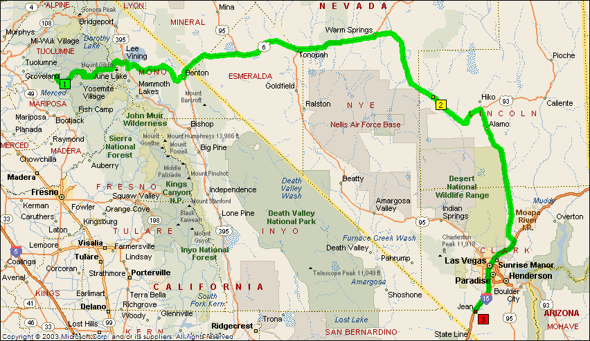
Day 37 - 8/21/2004 - In search of Aliens...
The plan for today was to cruise out though Yosemite, drive through Death Valley, and then on to Las Vegas for the night. Somehow, nature managed to dump a huge amount of water on Death Valley, which caused a flash flood, which washed out the roads. Funny what a little rain can do. Anyway, we pulled out Plan B (actually our original plan) to go through Rachel Nevada, near Area 51.
The drive out of Yosemite was incredible. The road meanders out of the backside off the valley. The scenery is awash with meadows and beautiful rock formations. Being that this was Saturday morning, there were quite a few folks roping up for climbs. As we drove out of the park, we started seeing some snow, indicating that this side of the park was higher and less arid.
Once you leave the park, you are thrust into canyon country immediately. Within just a few minutes, the trees give way to rocks, and streams become dry lake beds. We passed by the highest point in Nevada - Boundary Peak. This is not on our list of climbs for this year - we will geet that next year when we come to Mt. Whitney in CA. Going past Tonopah, there was a sigh - next gas 90 miles. Makes you think. Shortly after that, we encountered an old aircraft hangar that had been abandoned after WWII. We kept going east until Warm Springs, where we picked up the "Extraterrestrial Highway". While this alien stuff is all hyperbole, it is nonetheless fun. As you pull into Rachel NV, you see the "Little A'le'Inn" on the right. This is essentially a shack that sells cold Coke (so cold there was ice in the can) and alien trinkets. They have T-shirts, alien dolls, bumper stickers, and maps to Area 51. Rachel is the closest town to Area 51, and as such it claims this fame. I bought one of the maps, and it tells you where to go, where NOT to go, and how far you can go without being shot. I would print a copy of the map here, but I would have to kill everyone who viewed the page (and I'm too tired for that).
We headed south into Las Vegas. Hunter had a chance to "cruise the strip" and take in all of the lights. After fighting traffic we headed south to Jean, NV for the night.
|
|
|
|
|
|
|
|
|
|
|
|
|
|
|
|
|
|
|
An old aircraft hangar in the middle of nowhere (past Tonopah) |
Boundary Peak Nevada in the distance (smaller peak just to the left of the high peak) |
|||
|
|
|
|
|
|
|
|
|
|
|
|
|
|
|
|
|
|
|
|
|
|
|