Day 2 - 7/17/2004 - Tripple Bagger
I will spoil the ending by stating that as I write this, I am in a beautiful campground on the backside of Mt Greylock in NW Massachusettts. Amidst the quiet and solitude, I am composing by headlamp next to a roaring fire. Hunter just got through toasing marshmallows, and we had our fill of beef stew. I'll see how long I can type...
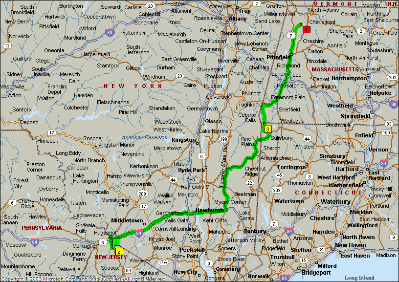
We got out of Port Jervis early, and were able to reach Highpoint State Park by 8:15 am. We easily found the summit, snapped some pics, logged the coordinates, and drove on. Our next scheduled highpoint was Mt. Frissell. This is an unusual highpoint, in that the highpoint is actually on the side of a mountain (the summit is in Massachusetts, and the highpoint is on the state line). This is one of two states where the highpoint is on the side of a mountain (Boundary Peak in Nevada being the other). No traffic - we made great time. Our SUPER-GPS was right on the mark (am I conveying the proper sense of sarcasm and impending disillusion?...) We made left turn in Millerton NY, and headed for the trailhead. Interesting thing - the SUPER-GPS showed us driving up the side of the mountain. No need for, roads, we have.. (oh nevermind!). Luckily we had and old-fashioned map and backtracked our way to Salisbury CT, where we took the winding dirt road to the the trailhead.
The trail to Mt Frissell was very pretty with some very rocky and steep sections. Although this is not high compared to other states, it is a very primitave trail that is well marked but somewhat overgrown. The trail climbs up the side of Round Top Mountain, and back down to the "saddle" between the peaks. Then it is back up through some steep boulders, over the top of Frissell, and back down the south side until we reached the state line. There were some very nice rock outcrops with great views. A short stop at the highpoint was made shorter as we started hearing thunder. Scarf down the Deviled Ham and crackers, and back on the trail to return.
It at this point in the synopsis I should probably intoduce my ankles. They have a penchant for finding holes, ruts, and small cliffs. In this case it was a pointed rock hidden in the overgrowth. There was an undenialable wave of pain, but I was able to catch myself before I did major damage (read: SNAP). The first though in case like this is always "how bad is it", follwed by, "how am I supposed to climb back down", followed by some choice words. I stayed on it, took it slow, and it seemed to loosen up. It hurt, but it was not terrible. The weakness was more of a concern. Anyway, we made it back to the car by 3:15 PM (2.5 hours round trip), and headed off toward Mt Greylock in MA. Given the concerns about our SUPER-GPS, we augmented with low-tech.
Made GREAT time up to Mt Greylock, and actually reached a capsite by 5:15 PM (always wondered what they look like during daylight!). We set up camp, and went up to the highpoint. It is truly beautiful and has a small lodge on top. The view is great, and I got to see the shadows of the mountain cross the valley as the sun was setting.
Driving through the mountains makes me makes me really miss that special one in my life. Her gentle curves, her beautiful figure, her lucious color. I'm of course talking about my S2000!!! I wish it could have fit in the luggage!
We will see how the ankle is in the morning - and if it affects the trip
in any way. It is getting chilly, and it is time for a few hand of Go
Fish with Hunter.