|
Peak Name
|
White Butte
|
|
Date of Climb
|
August 2, 2004 |
|
Published Height
|
3506 ft |
|
Measured Height
|
3527 - GPS
|
|
Vertical Climb
|
397 ft (3130 measured at start) |
|
Published GPS Coordinates
|
Lat N46º
23' 12" Long W 103º 18' 09" |
|
Measured GPS Coordinates
|
Lat N46º
23.224' Long W 103º 18.153' |
|
Height Rank
|
30 |
|
Difficulty Rank
|
23 |
|
|
|
|
|
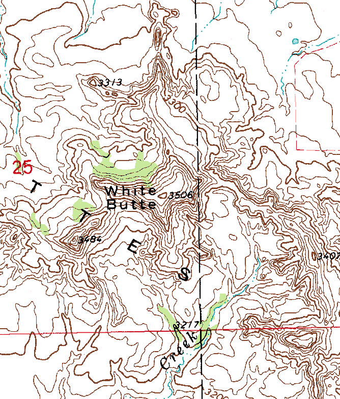
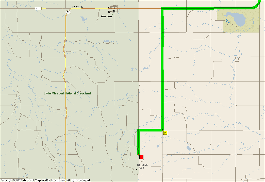
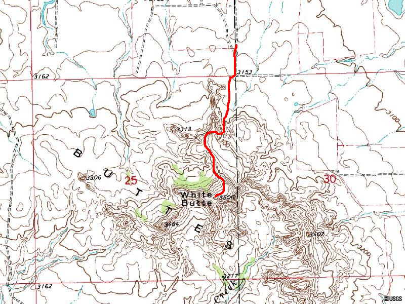
White Butte was another peak that defied expectations. First
of all - no rattlesnakes! We looked high and low, under rocks, behinds
trees, under the car, and the only thing we saw were bugs. We started
our hike at about 11:30 am, so it is possible that they had all go home to avoid
the sun, or watch soap operas, or the like. We did encounter "cattle
with an attitude", but they stayed on their side of the fence and so we
were all happy.
The hike to the butte is fairly uneventful, and takes about
30 minutes to reach the peak. Again, thanks to Charlie Winger for excellent
directions on getting there and climbing the highpoint. Some extra notes
while they are still fresh in my mind.
- Not only did we find no one home at the Van Daele's farm,
it looked like it had been years since anyone had lived there. There
was a pickup truck, and we left the requisite "donation".
- It was a little tough finding parking that was not in
high grass or on the dirt road. We finally found a good spot next
to the big tree just before the old farmhouse
- Per the instructions in Charile's book, DO NOT drive
past the farmhouse unless you can manage deep sand. The road ends
just past the farmhouse anyway, so it won't save you much walking.
- At the end of the road there is a gate - it was tied
shut. It was very easy for us to step between the wires.
- There are several side trails shortly after you cross
through the gate - follow the fence as far as you can. Once you reach
the first steep section, you can go up next to the fence, or more to the
right. I think going to the right was a little easier.
- The trail will wind a bit but is fairly apparent from
this point on. The grasshoppers really do sound like "rattling",
so they can be a bit unnerving if you are not expecting one to jump out
at you.
- Unless you really drag your feet or are severely out
of shape, round trip time is about 1 to 1 1/4 hours.
- Watch the weather - This would not be a fun one to come
down in the rain (esp a thunderstorm)!
I read somewhere that there is an alternate path to the summit
from another farm. It looked like there were several farms just a short
distance (visible to the east, and also the west I think), that do not charge
the fee. It looked like the access from either the east or west would
be fairly straightforward.
The view is really spectacular! I though I would be
looking at a lot of flatlands and scrub brush. Instead, there are fantastic
views of buttes and mesas in all directions. We saw a shape to the northwest
that looked like a giant Aztec pyramid, with the sun glinting off of the top.
The view is so far in all directions, it is tough to describe.

)
)
)
)
)
)
)
)
.jpg', 'nph_window', 'width=400,height=400,toolbar=no,menubar=no,status=yes,scrollbars=yes,resizable=yes'))
.jpg', 'nph_window', 'width=400,height=400,toolbar=no,menubar=no,status=yes,scrollbars=yes,resizable=yes'))
)
)
)
.jpg', 'nph_window', 'width=400,height=400,toolbar=no,menubar=no,status=yes,scrollbars=yes,resizable=yes'))